Vi beklager Denne side findes endnu ikke på dansk, så vi viser den på originalsproget istedet
The terrain at the ALMA site

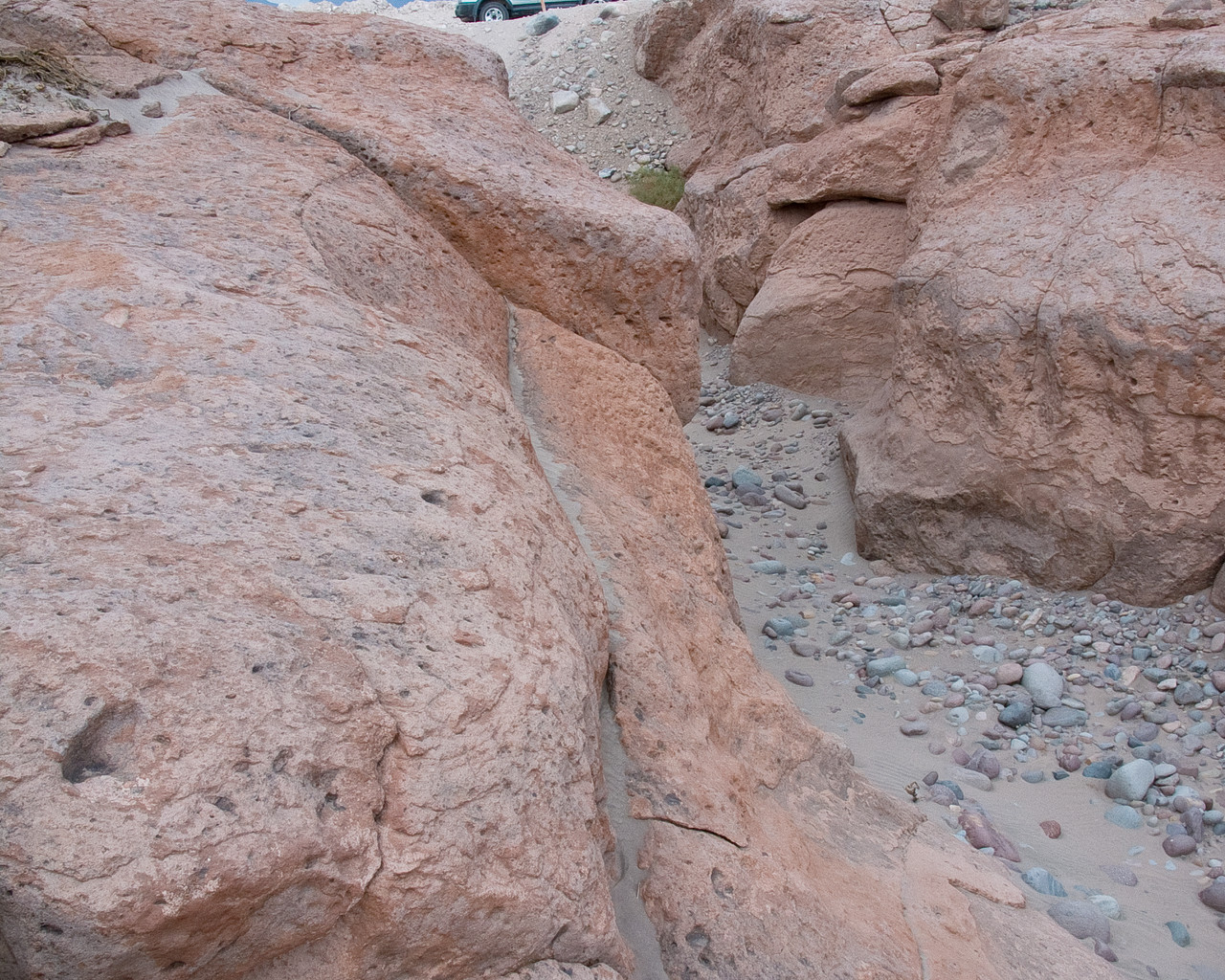
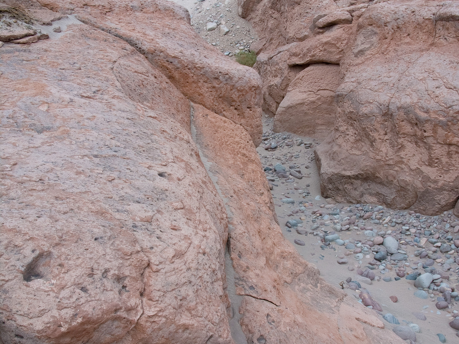
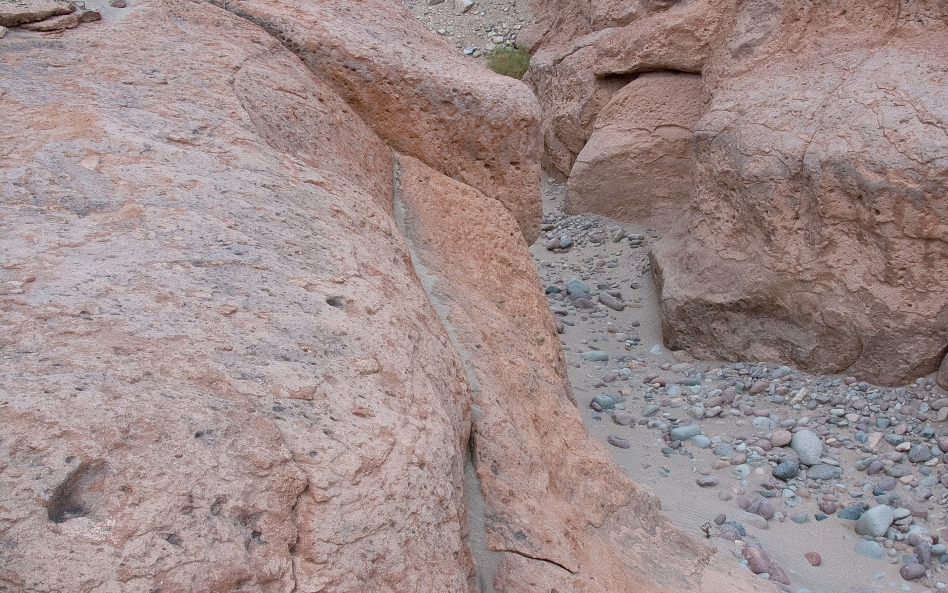
In the picture, a typical reddish rock formation along the road that goes up to the Chajnantor plateau, home of the Atacama Large Millimeter/submillimeter Array. Around and above the ALMA Operations Support Facility (OSF), located on the same road at 2900 m altitude, many grooves and gullies produced by the water flow, which was probably more abundant in the past, can be observed.
Kilde:ALMA (ESO/NAOJ/NRAO)
Om billedet
| Id: | alma-hh-21 |
| Type: | Foto |
| Udgivelsesdato: | 14. juni 2010 17:55 |
| Størrelse: | 1920 x 2552 px |
Om objektet
| Navn: | Chajnantor |
| Type: | Unspecified : Technology : Observatory |
| Kategori: | ALMA |