SPHERE maps the surface of Ceres
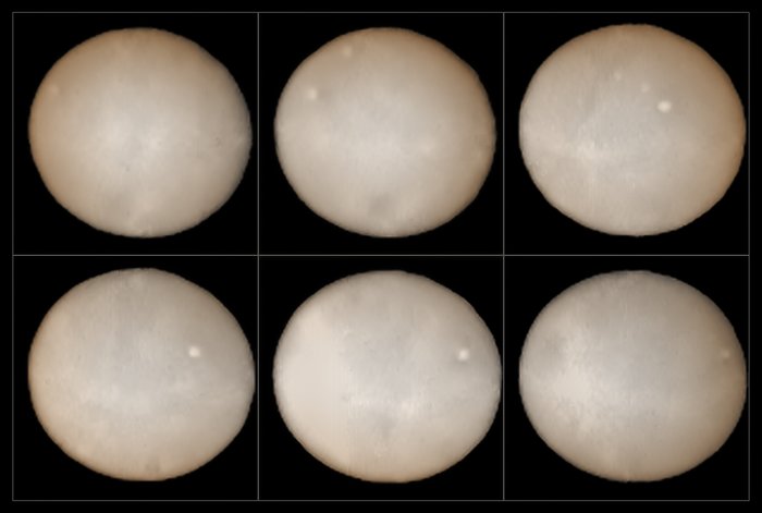
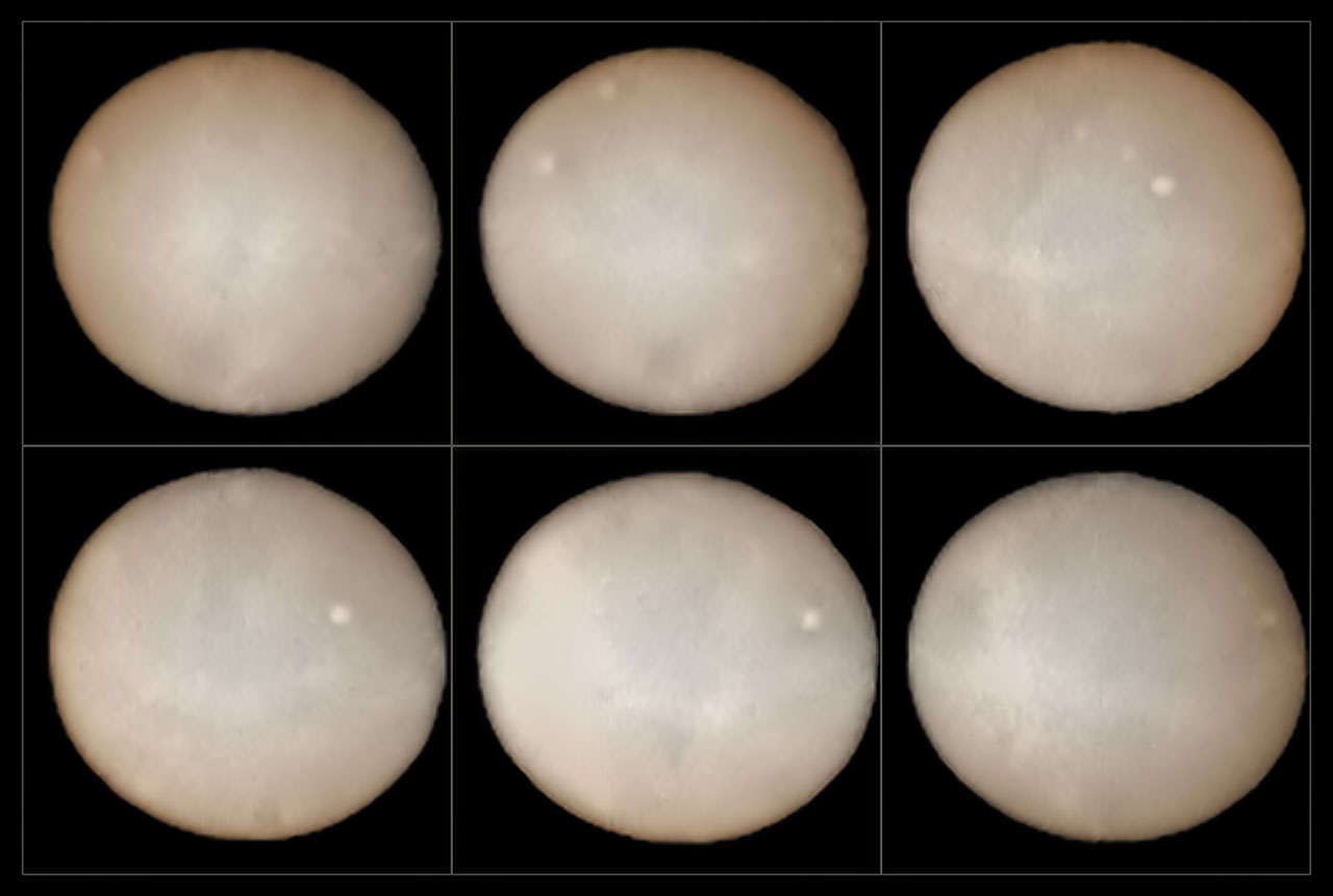
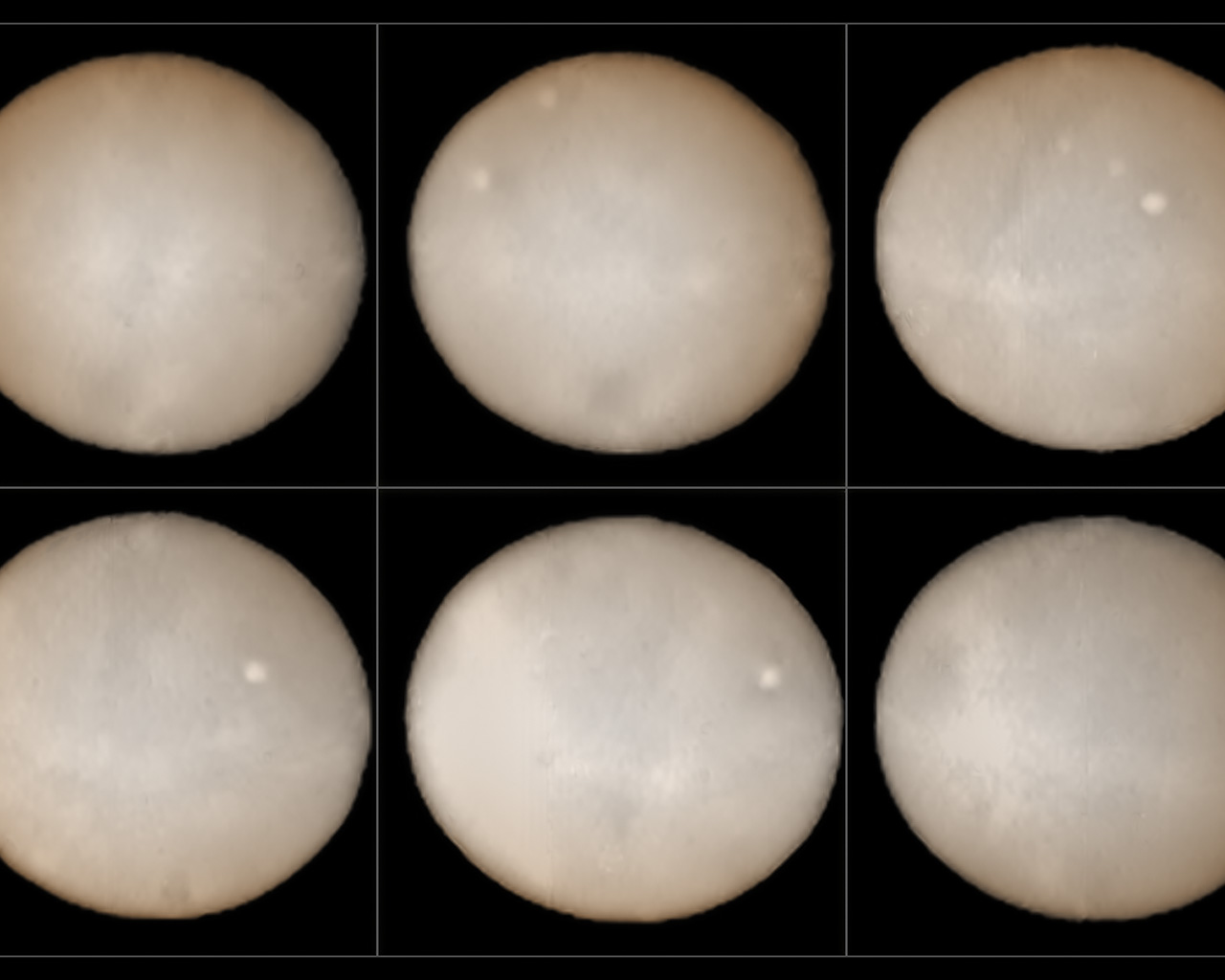
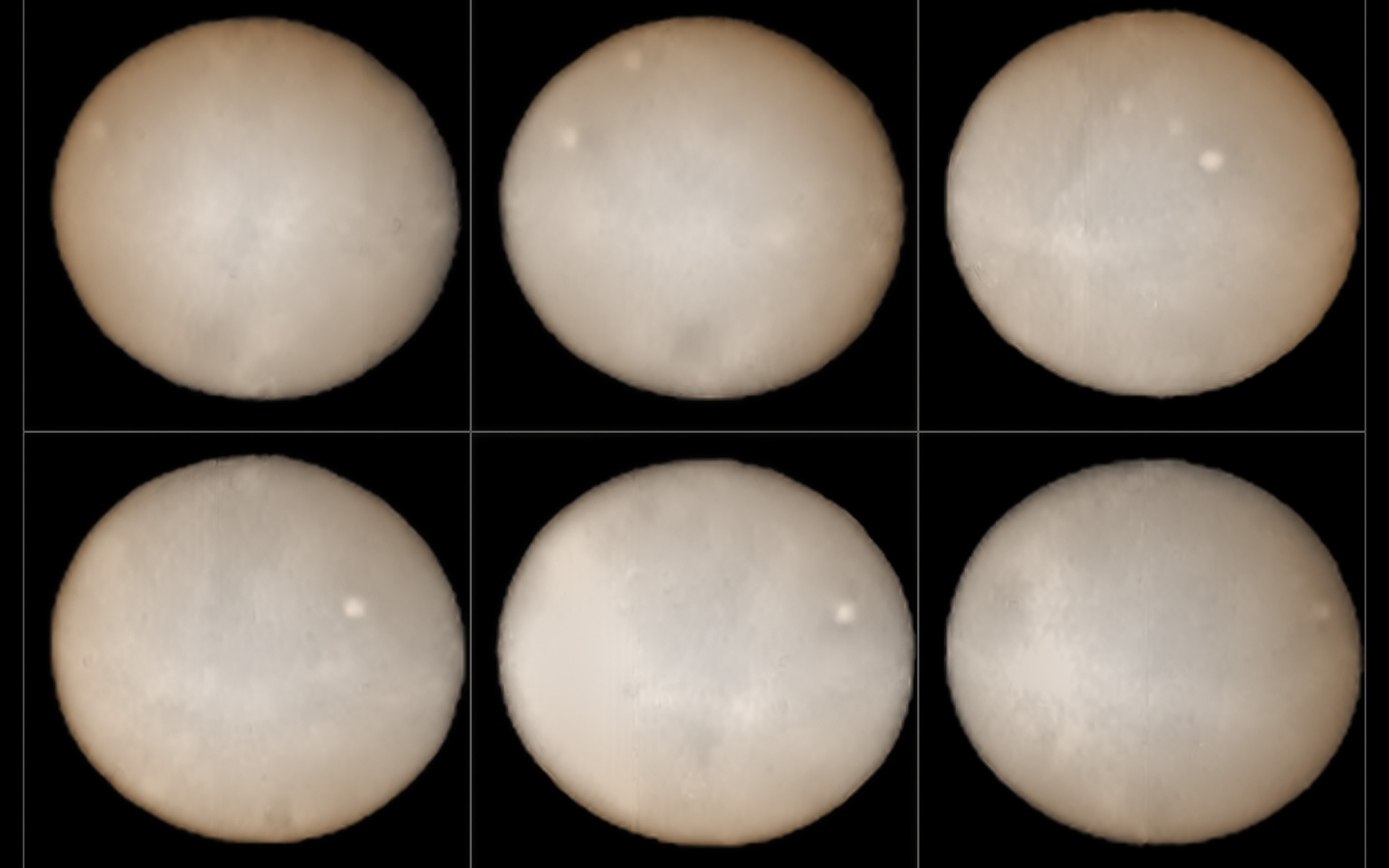
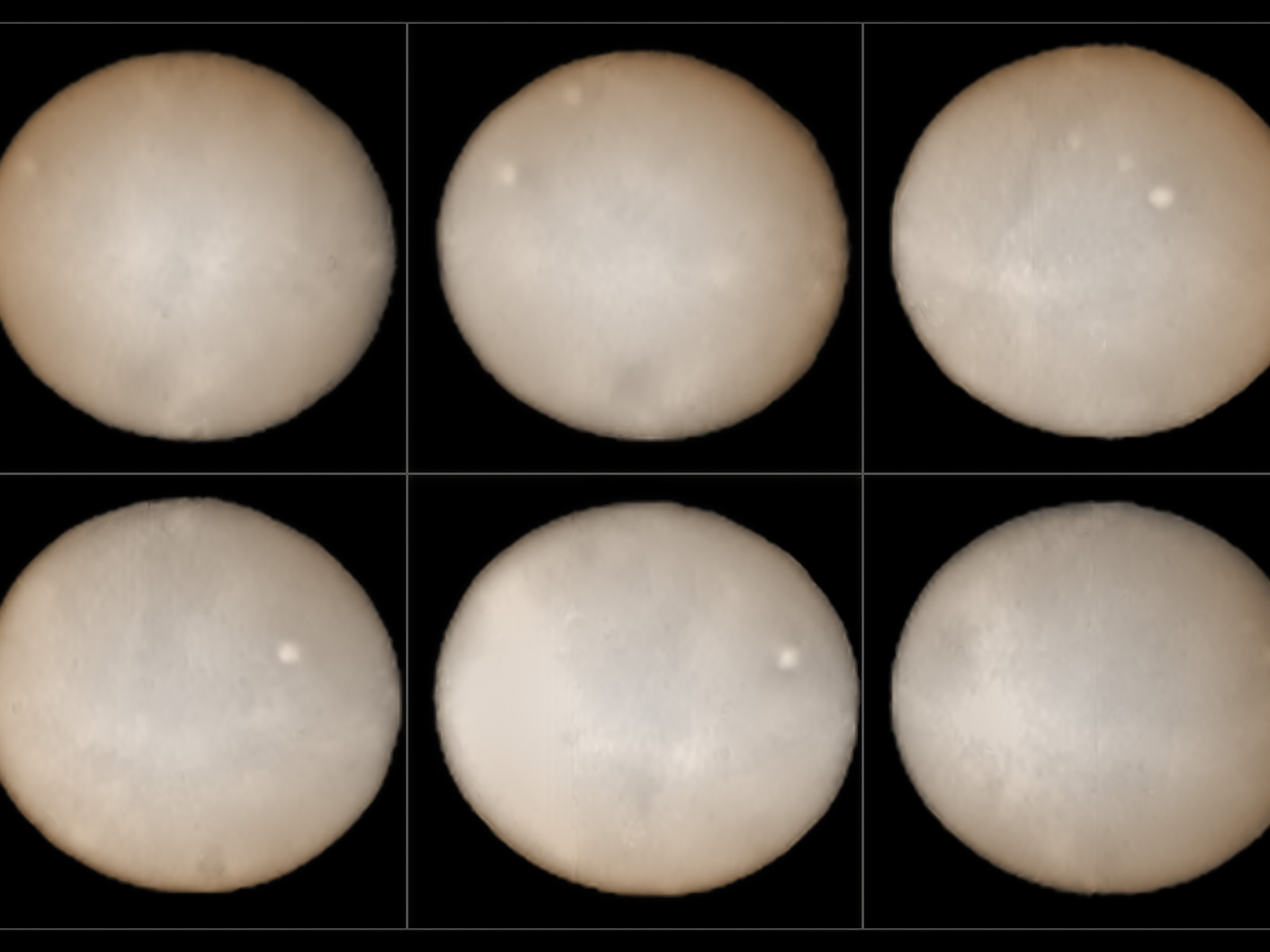
These images, taken two weeks apart, show the two hemispheres of Ceres and provide the best ground-based observations of the dwarf planet ever. They were taken using the SPHERE instrument on ESO's Very Large Telescope and form part of an effort undertaken since mid-July 2015 to compose a polarimetric map of the object's surface.
Orbiting in the asteroid belt between Mars and Jupiter, a region known as the Main Belt, Ceres was the first asteroid to be discovered in 1801 and is the largest Main Belt asteroid. It is the largest reservoir of water in Earth's neighbourhood. Most of this water is thought to exist in the form of water ice in the object's mantle.
The surface of the dwarf planet is about the size of India and several intriguing bright spots can be seen in these new images. These mysterious bright patches have also been looked at more closely by NASA's Dawn spacecraft, currently in orbit around Ceres. Astronomers have scrutinised them, but their true nature remains obscure. It is hoped, however, that by comparing the data obtained using SPHERE with the images Dawn is sending to Earth, astronomers should soon be able to begin decoding the Ceres enigma.
Källa:ESO, B. Yang and Z. Wahhaj
Om bilden
| ID: | potw1536a |
| Typ: | Planetarisk |
| Publiceringsdatum: | 7 september 2015 10:00 |
| Storlek: | 1254 x 844 px |
Om objektet
| Namn: | Ceres |
| Typ: | Solar System : Interplanetary Body : Dwarf planet |
| Kategori: | Solar System |
Skrivbordsunderlägg
Färger och filter
| Band | Teleskop |
|---|---|
| Very Large Telescope SPHERE |