Es tut uns sehr leid. Diese Seite ist in der von Ihnen bevorzugten Sprache noch nicht verfügbar. Wir zeigen Ihnen stattdessen die Originalfassung.
The terrain at the ALMA site

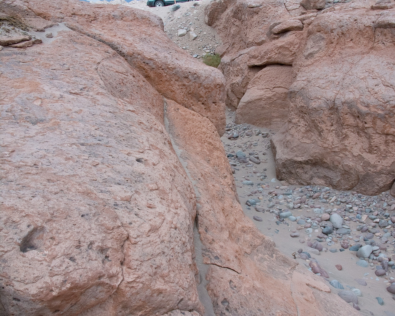
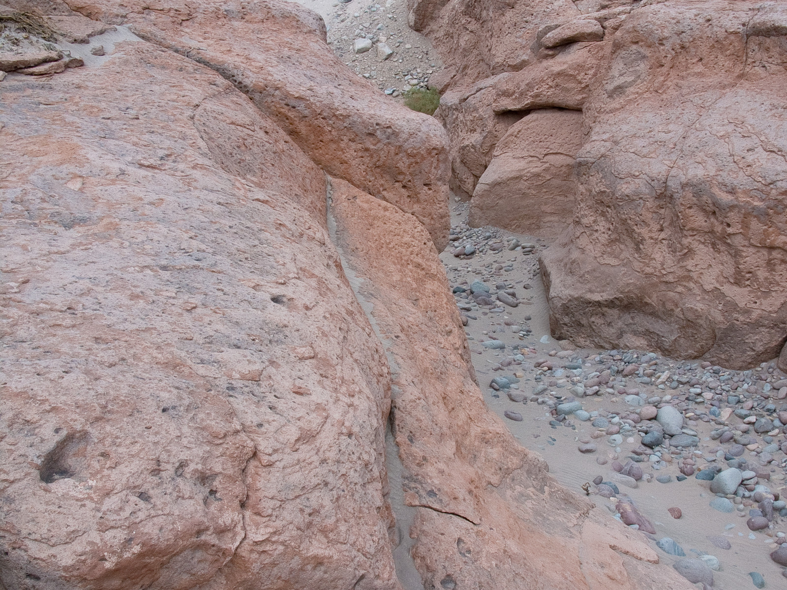
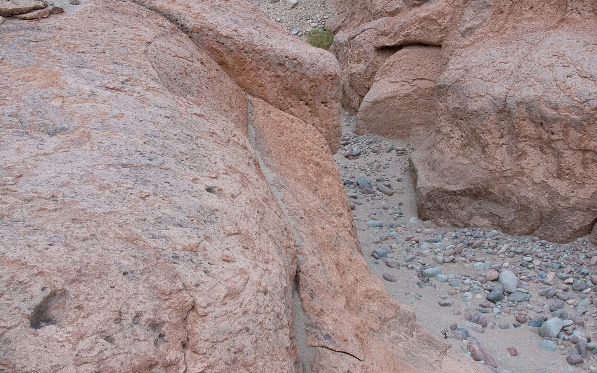
In the picture, a typical reddish rock formation along the road that goes up to the Chajnantor plateau, home of the Atacama Large Millimeter/submillimeter Array. Around and above the ALMA Operations Support Facility (OSF), located on the same road at 2900 m altitude, many grooves and gullies produced by the water flow, which was probably more abundant in the past, can be observed.
Bildnachweis:ALMA (ESO/NAOJ/NRAO)
Über das Bild
| ID: | alma-hh-21 |
| Typ: | Fotografisch |
| Veröffentlichungsdatum: | 14. Juni 2010 17:55 |
| Größe: | 1920 x 2552 px |
Über das Objekt
| Name: | Chajnantor |
| Typ: | Unspecified : Technology : Observatory |
| Kategorie: | ALMA |