Sorry! This page is not yet available in your preferred language, so we're displaying the original version instead.
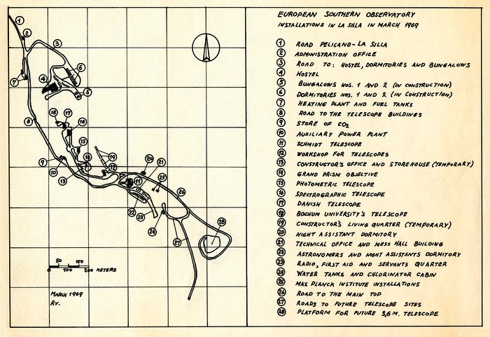
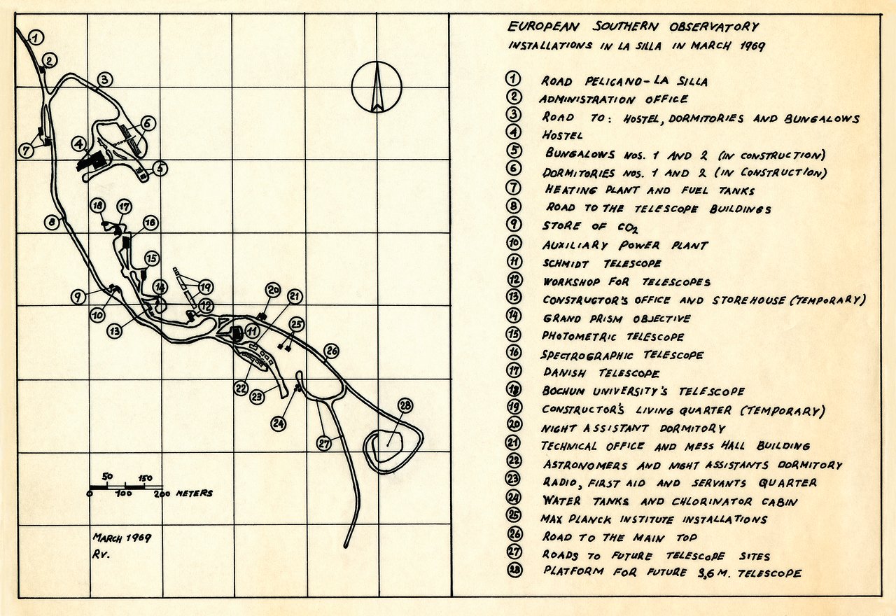
Map of the La Silla Observatory in 1969
A map of the La Silla Observatory facilities in March 1969, around the time the observatory was officially inaugurated.
Kredit:ESO
O snímku
| Id: | ehpa-11-1969-la_silla |
| Typ: | Kresba |
| Datum zveřejnění: | 18. března 2012 22:03 |
| Velikost: | 8791 x 6041 px |