
![[Image - Archaeologists]](../img/archeo1.jpg)
![[Image - Lost World]](../img/indy2.jpg)
We are living in an ever-changing world: New houses, new roads, where there was a marshland there is now a harbor! It may have happen that you come back to a place you have visited years ago that you can not recognize it again.
Topographical maps get old and out-of-date very quickly. As user of maps you might have already this experience.
The aim of this little exercise is to highlight such changes.
![[Image - ERS-1 Satellite]](../img/ers1.gif)
The image we provide has been taken by the ERS satellite (left) built and launched by the European Space Agency. There is a Radar aboard, able to watch the Earth's surface even through clouds and in darkness. Radar-images look similar to photographs but their interpretation is different (see the Radar Mini-Tutorial).
In a radar image the ocean is not blue but black and white and also has a lot of strange features. As a general rule, the brighter the sea surface the rougher the sea (the higher the wind speed).
But our image (below) is coloured! This is because it is composed by 3 images taken on 3 different days. In order to still distinguish the information coming from each of these days, each image was given a different colour:
All images were acquired at the same time of the day, at 10:20 GMT. In the case where all the 3 images are equal we would expect a black-and-white image, because in each point of the image we would find an equal amount of blue, green and red. And every change would be seen as colour: e.g. a little less blue in a place and invariant with green and red would turn the colour from gray to yellow, etc.
So, the colours in the image are linked to changes in radar respose or backscatter within this period of time. Although it is a very short period, backscatter on the sea may change rapidly because of the wind (see the Radar Mini-Tutorial). On the land, cities are very rough surfaces and appear generally very bright. Single houses are visible as bright points, if not too densely built all together. Forest and fruit-tree plantations are less bright features. On the other hand, grassland are smooth surfaces and appear dark in the radar image; runways and highways are even smoother, they appear nearly black.
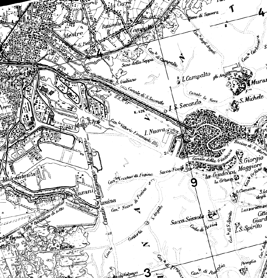
![[Venezia - Image]](ex2.jpeg)
If your browser supports JAVA, you can view the applet that permits you to see the individual channels and the map. Otherwise you can simply view the map.
What are then the changes? We see them as colours spots. Are these new houses built within the period May to September in 1992. Surely not! What could it be then by the sea?