¡Lo lamentamos! Esta página no está disponible en la lengua seleccionada, en su lugar le mostramos la versión original.
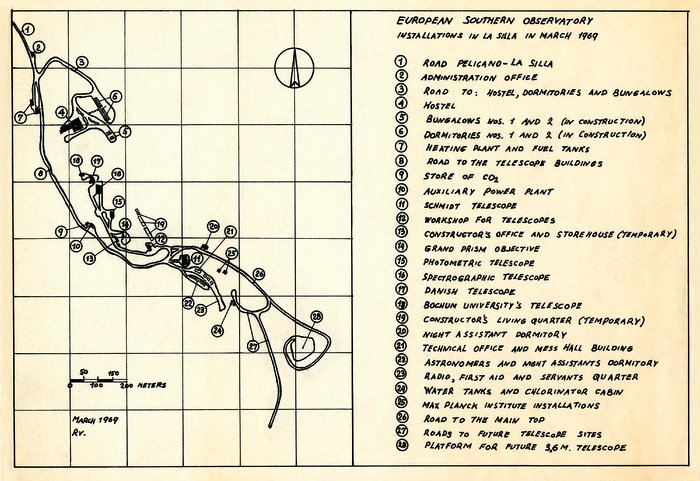
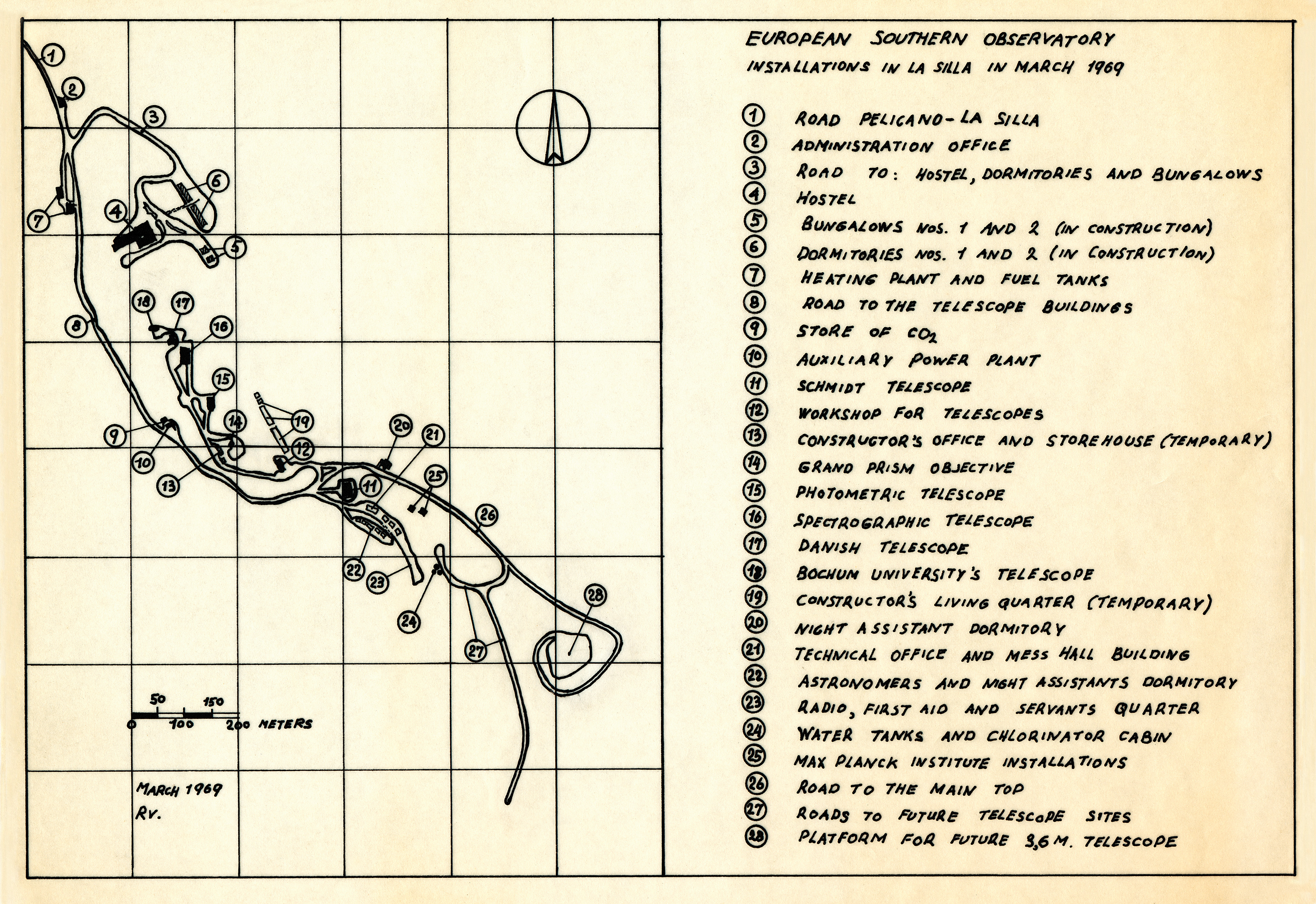
Map of the La Silla Observatory in 1969
A map of the La Silla Observatory facilities in March 1969, around the time the observatory was officially inaugurated.
Crédito:ESO
Sobre la imagen
| Identificador: | ehpa-11-1969-la_silla |
| Tipo: | Ilustración |
| Fecha de publicación: | 18 de Marzo de 2012 a las 22:03 |
| Tamaño: | 8791 x 6041 px |