ALMA's antennas spread across the Chajnantor plateau
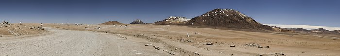
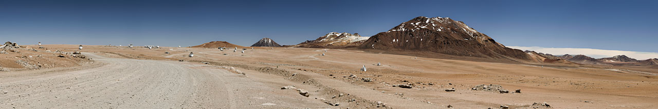
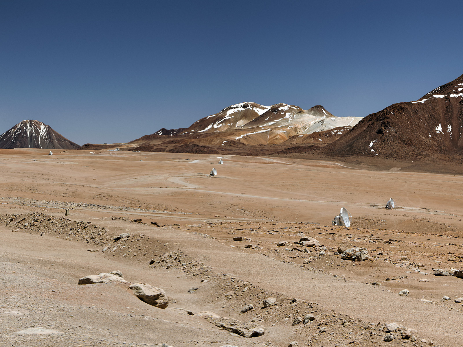
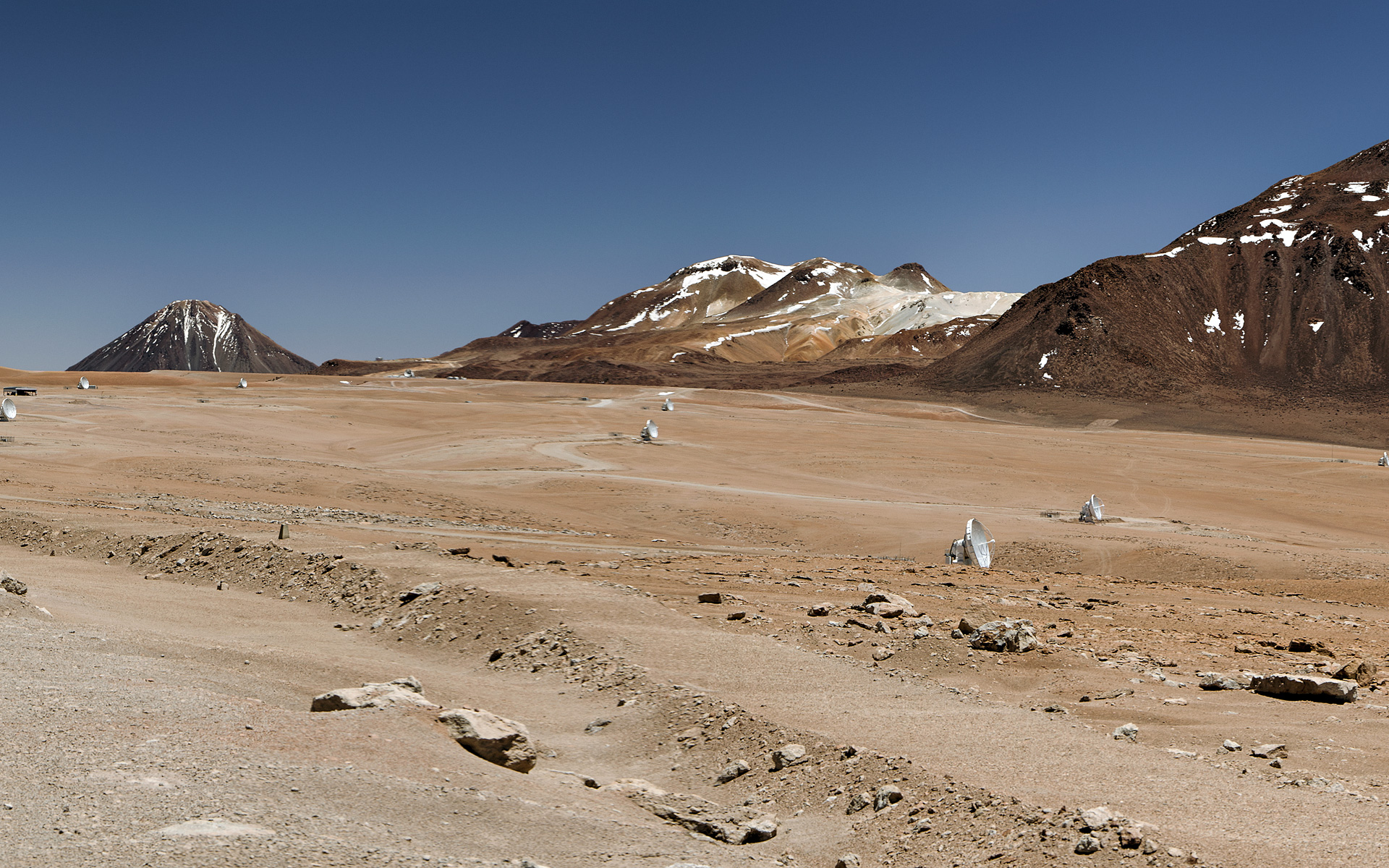
This daylight panoramic image shows the Chajnantor Plateau with the road from the ALMA Operations Support Facility (OSF). Some of the 50 large ALMA's antennas (with a diameter of 12 metres) can be spotted, spread over distances of up to 16 kilometres on the plateau. In the centre of the image, from right to left Cerro Chajnantor, Cerro Toco, and Juriques rise up to the sky. The Chajnantor Plateau is located 5000 metres above sea level and it serves as an ideal hunting ground for ALMA. The ALMA array uses observations at the millimetre and submillimetre wavelengths to explore the most distant galaxies in the Universe and the Chajnantor Plateau, one of the driest places on Earth, offers extremely low levels of absorption and attenuation by water vapour of this kind of radiation.
Crédit:ESO/Sergio Otarola
À propos de l'image
| Identification: | alma_ext_a1-cc |
| Type: | Photographique |
| Date de publication: | 2 février 2016 09:26 |
| Taille: | 11667 x 1930 px |
À propos de l'objet
| Nom: | Atacama Desert, Atacama Large Millimeter/submillimeter Array |
| Type: | Unspecified : Technology : Observatory |
| Catégorie: | ALMA |