Pahoittelumme! Tämä sivu ei ole vielä saatavilla haluamallasi kielellä, joten näytämme sen sijaan alkuperäisversion.
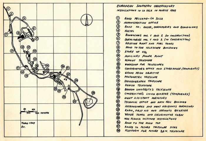
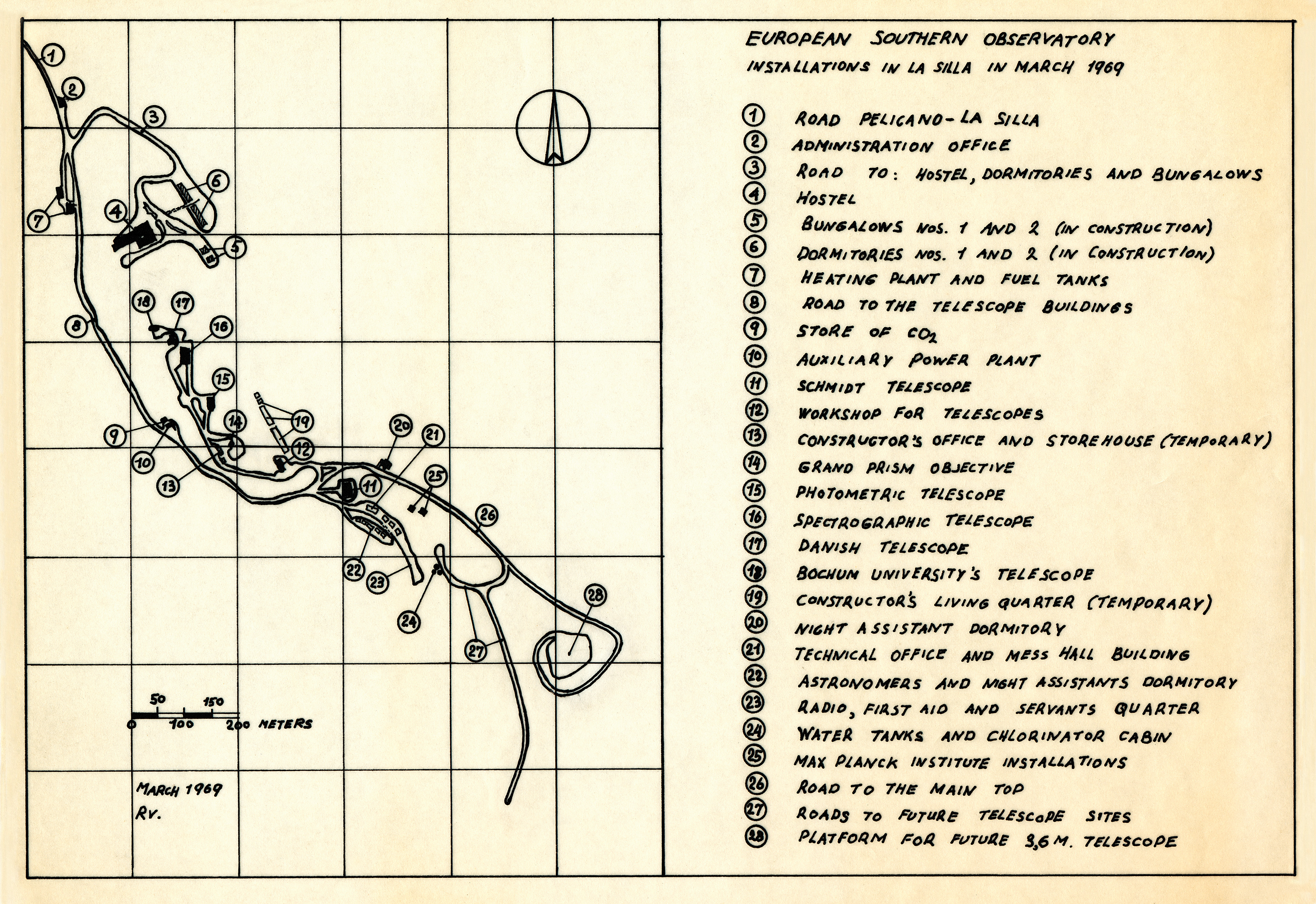
Map of the La Silla Observatory in 1969
A map of the La Silla Observatory facilities in March 1969, around the time the observatory was officially inaugurated.
Oikeudet:ESO
Kuvasta
| Tunnistus: | ehpa-11-1969-la_silla |
| Tyyppi: | Kuvitus |
| Julkaisupäivä: | 18. maaliskuuta 2012 22:03 |
| Koko: | 8791 x 6041 px |